

Nigeria
The National Map
Thirty-six states and the Federal Capital Territory — from the Gulf of Guinea to Lake Chad.
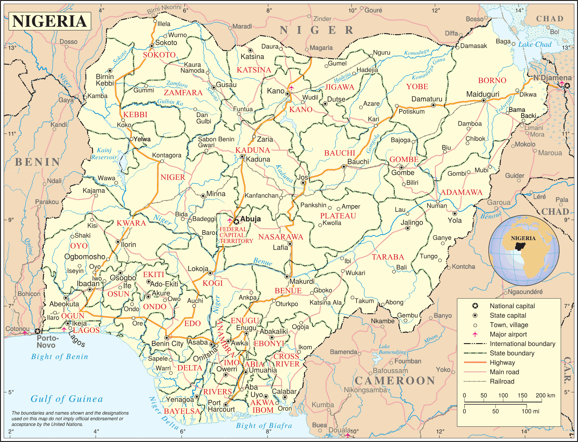
United Nations cartographic map of Nigeria, via Wikimedia Commons (public domain).
36 + FCT
States, plus the Federal Capital Territory of Abuja
6
Geopolitical zones
4
Neighbours — Niger, Chad, Cameroon, Benin
~800 km
Atlantic coastline on the Gulf of Guinea
The Federation
Six zones, thirty-six states
North Central
BenueKogiKwaraNasarawaNigerPlateauFCT Abuja
North East
AdamawaBauchiBornoGombeTarabaYobe
North West
JigawaKadunaKanoKatsinaKebbiSokotoZamfara
South East
AbiaAnambraEbonyiEnuguImo
South South
Akwa IbomBayelsaCross RiverDeltaEdoRivers
South West
EkitiLagosOgunOndoOsunOyo